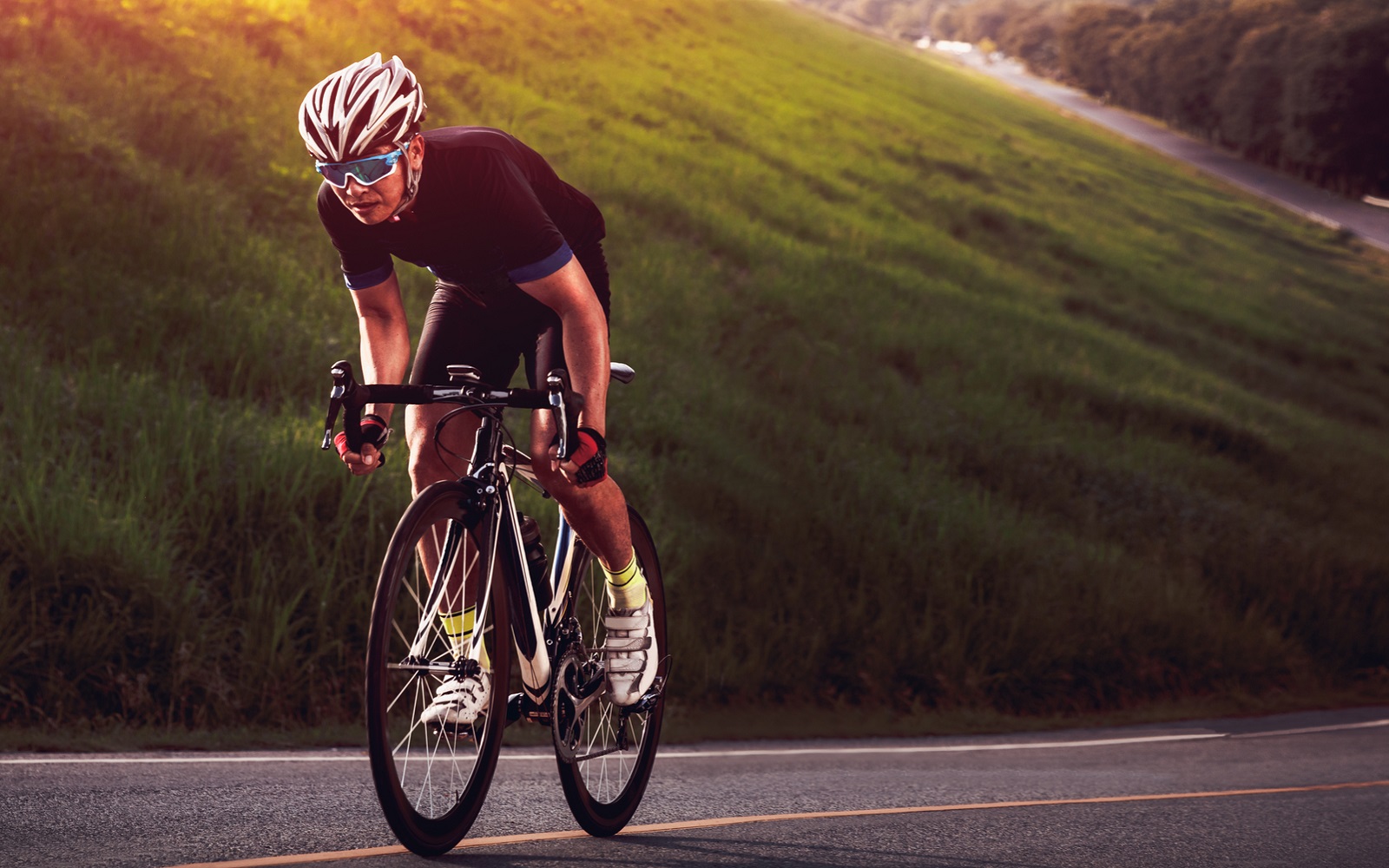
Two Guys Who Love to Ride
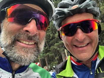
We all love to ride our bikes in the hills of the front range, but these two guys take it to another level. Gaspar Terrana and David Knutson thrive on long epic rides. They cycle from their homes in the Denver area and head west into the mountains looking for the steepest climbs and highest passes. This spring they have been challenging themselves by riding to elevations where the road is still covered in snow. Last spring their first summit of Mt. Evans was in early June and the last was in October. They both completed 2022 with over 14,000 miles and 1.2 million feet of climbing.
Gaspar’s typical ride begins early in the morning and ends around dinner time, typically between 100 and 150 miles and 8 to 10 hours in the saddle. Gaspar has a rule, never put your bike in a car! Last year he rode 180 miles to Salida so the next day he could ride the Salida 76-mike gravel bike race.
David posted 394 rides last year on Strava, including countless indoor rides on Zwift. David and Gaspar created a ride they call “Fourteening a 14er,” meaning they ride from their doorsteps to the top of Mt. Evans and then continue to ride until they each have climbed a total of 14,000 feet and have ridden 140 miles.
The most remarkable thing about these two, other than their strength, is the passion and exuberance they have for the sport. When asked “why do you ride to such extremes?”
Gaspar: “My riding is enjoyable and feeds positive emotions which leads to a positive loop – the more riding, the better I feel.”
David : “There is nothing like a sustained climb on a bike, and the peace and serenity of the mountains is intoxicating.”
Many friends have enjoyed the company of Gaspar and David on long rides, but very few can complete an entire epic ride.
Do you really need another bike?
For the last few years graveling has been the biggest trend in cycling. In 2020 I finally succumbed and bought a used cyclocross bike so I could join in the gravel biking craze.
Am I glad I did? Absolutely yes!
- It’s fun! Riding dirt trails makes you feel like a kid again. Exploring new terrain on a gravel bike is a blast! You can ride not only gravel roads but also smooth single track. The wider the tires you use (say 45mm), the rougher the trail you can ride. The narrower the tire (say 38 mm), the faster you’ll be on smooth gravel roads and pavement.
- Safety – You can get away from traffic and find safer places to ride then on the streets and highways. And you’re less likely to crash than mountain biking because you’ll be on less challenging trails.
- Versatility – A gravel bike is better for year around riding and commuting. The knobby wider tires can handle snow and ice much better than road tires. You can ride any road surface and jump curbs too! The gravel bike has been described as the SUV of bikes because of its versatility. I would say that on pavement a high-end gravel bike may be only 10% less efficient than a very light road bike.
- Comfort – Generally gravel bikes are a little more comfortable than a road bike with a slightly more upright position and fatter tires.
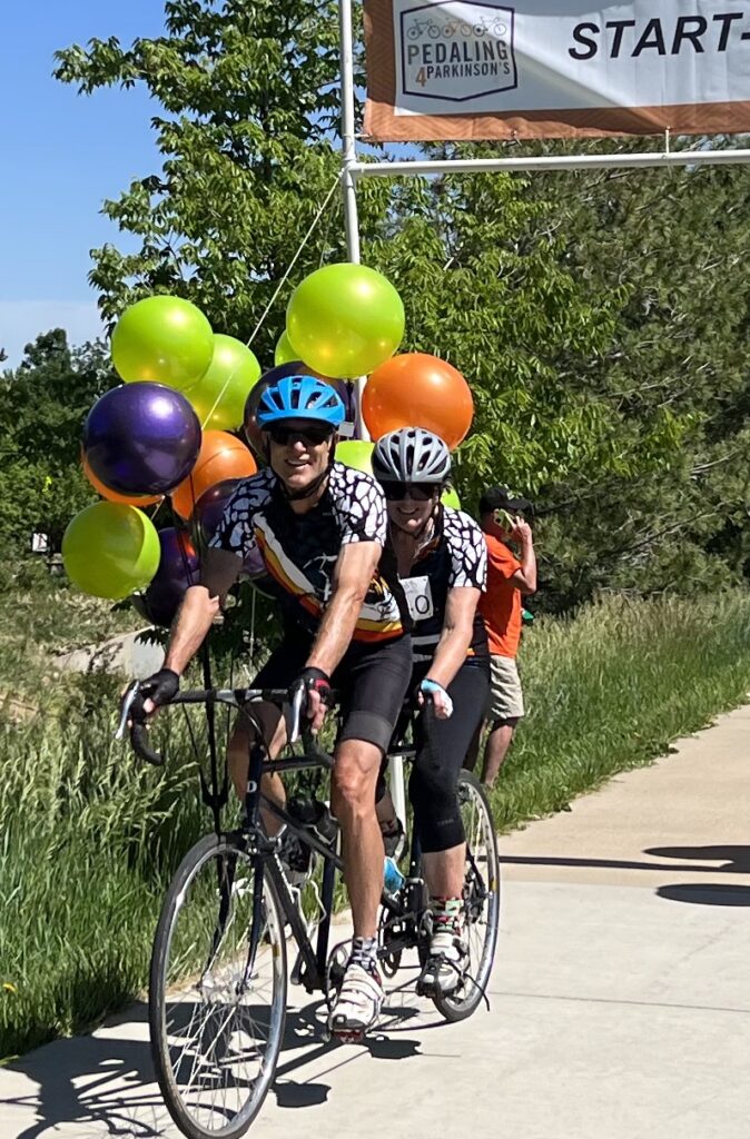
- Events – In the last 2 years, I have entered two gravel bike races, the Crippler (Canyon City to Cripple Creek and back) and the Steamboat Gravel (SBT GRVL). I found both of these events to be challenging and fun! Both events were had a very friendly and supportive in terns of the organizers and riders. You actually ride in the same event as top-tier racers, but can either do the course as a race, or a ride at a comfortable pace.
Colorado has many great destinations for long gravel bike rides including Boulder, Fort Collins, and Steamboat Springs. Although Jefferson County is not considered a destination spot for gravel biking, there are lots of places to ride, including less technical trails in our thousands of acres of open space. Some of the County, State and local parks with significant gravel riding include South Valley Park, Hildebrand Park, Chatfield State Park, Bear Creek Lake Park, Green Mountain, and South Table Mountain. If you go further east there’s the East-West trail south of Highlands Ranch, and of course the 72-mile Highline Canal trail that starts near Waterton Canyon and goes all the way to Green Valley Ranch near the airport. There are also many miles of ridable gravel roads in the Rike national forest around Deckers and South Park. A great website for finding gravel riding is gravelmap.com.
So, if you can afford a beautiful new high-tech $8000 gravel bike, go for it! On the other hand, you can pick up a good old quality mountain bike (hardtail or no shock) on Craigs List for less than $300 and do pretty much the same kind of riding.
So, you may not need another bike, but it certainly can be justified!
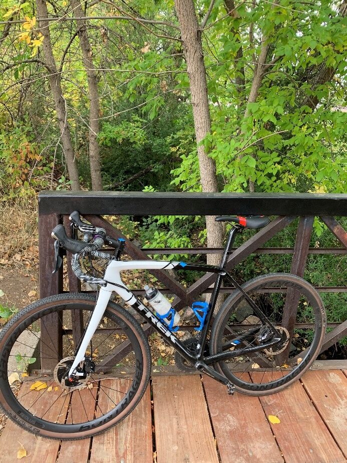
I used my gravel bike on a cool day in Autumn to explore the Dutch Creek trail in the southwest metro area. The ride included pavement, paved paths, and dirt paths. Remember, exploring is the essence of an interesting and rewarding life!!
– Steve Roe
E-biking the Great Divide Mountain Bike Route
By Stan & Jenny Sunderwirth
The Great Divide Mountain Bike Route is a 3087-mile mountain- and gravel bike route along the North American Continental Divide developed by the Adventure Cycling Association (ACA). It starts in Jasper, Alberta, Canada and finishes in Antelope Wells, New Mexico on the Mexican border. There is an alternate finish south of Columbus, NM, across from Porto Paloma, Mexico. The ACA sells maps for the route that include tips and lodging/service information including locations to get water, food and bicycle shops.
The route is 90% unpaved “gravel” road, jeep trail or double-track with 3% single-track and over 150,000 feet of climbing. The rest is paved road or highway.
The route has some alternate paths along the route that can be taken for variety or in case inclement weather has closed the main path. One alternate is the finish just south of Columbus, NM instead of Antelope Wells. The latter is just a border crossing with no town or services. Columbus, NM and Porto Paloma are both towns with hotels, restaurants and other services.
The central parts of New Mexico from Abiquiu to Cuba, Cuba to Grants and Grants to Pie Town has paved alternate paths because in wet weather, the unpaved roads are truly impassable with thick, viscous mud. The road signs warn of this.
There is an alternate route (the Columbine Alternate) between the Wyoming-Colorado border and Steamboat Springs that can be taken if the main route north of Steamboat Springs is blocked by snow.
There are other small alternate routes that can bypass some sections that might be too mountainous or lacking water or other services for some riders.
One significant alternate route out of the Great Divide Basin in Wyoming passes through Wamsutter instead of Rawlins. This alternate avoids heavy truck traffic on a highway without a shoulder coming out of Rawlins.
The GDMBR crosses over the Continental Divide many times. Just about every day you cross over from one side to the next. The route also intersects the Continental Divide Trail (CDT) and the Colorado Trail in several places. Especially in places where the CDT and GDMBR intersect, you might find “trail angels” who set up stashes of water or snacks. These might be manned or unmanned. While these can be a godsend, you cannot count on them being there.
Every year, there is a race along the route in June/July called the Tour Divide. The race is actually two races: one northbound and one southbound. The official route deviates from year to year from the Adventure Cycling route in various places based on local conditions and also to provide a more interesting/challenging route for the racers. GPX files are available for free for the race routes while the GPX files for the ACA routes are for sale. We use the GPX file from the 2017 race as we think it’s the best route.
In 2022, most of the southbound racers got caught in a very heavy snowstorm just north of the Canadian border and many abandoned, hunkered down for several days or had to be rescued. The leaders made it through the area before the snow hit and finished in record time. The floods in the Yellowstone area also caused delays and detours. Meanwhile, much of the route in central New Mexico was closed due to extensive forest fires and the racers had to take paved detours around the national forests, which actually shortened the distance. In 2022, we escaped the fire closures in NM by two days and just missed the Yellowstone floods by ending our northward progress at Coulter Bay in Grand Teton National Park.
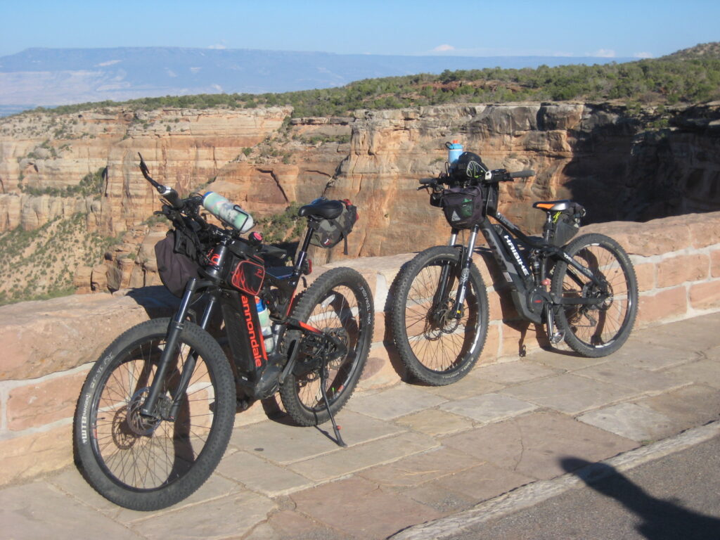
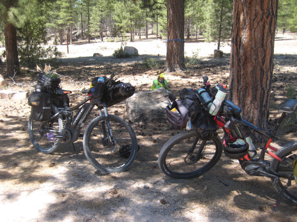
While the route was designed for traditional mountain or gravel bikes, you can ride e-bikes on the route. Many parts are rough, rock-strewn or sandy, so an e-mtb or e-gravel bike is highly recommended. Full suspension is not really needed, so a hard-tail e-mtb will generally be lighter and able to carry gear more easily. Having had two rear racks break on rough roads, we replaced them with the “Divide” rack sold by Old Man Mountain. It’s extremely sturdy and can carry 70 lbs if you attach it to the through-axle or skewer. The deck is a little short, however.
Many people take 6-8 weeks to cover the entire distance on a traditional bike. The majority of riders go north to south but some go the other way. The choice depends a lot on the time of year, the weather and prevailing winds. Because the route is so long and the climate along the route varies so much, it’s tricky to pick a time frame that will be ideal along the whole route. Snow or rain in the high altitudes and high latitudes is always a concern. Heat and dry water sources are a concern in southern New Mexico and across the Great Divide Basin in Wyoming. In these areas, the only water source may be a cattle tank which will have algae and insect larvae in it, so a good water filter is essential.
Black and Grizzly bears are a concern in Canada and Montana, so you need to be in a camp with bearproof lockers, carry bearproof containers or be able to hang your food from a tree. We have never had a problem with bears from Wyoming to the Mexican border, but it’s always a possibility.
For us, living in the middle of the route in Colorado, we have opted to do the whole route in short sections, taking 5-10 days for each section. This allows us to pick optimal weather for each section and not be away from home for too long. It can also alleviate some of the problems with stretches that have no water or charging opportunities. By starting or ending the section in the middle of a waterless or no-electricity stretch, you can split up those stretches. We almost always travel each segment from north to south, leaving a car at either end. Sometimes, we have made a loop going south on a section and coming back on the alternate route or on another trail.
You can also place one car at one end and another at the other end of a segment, ride back to the first car, then leapfrog that car further along the route and ride back to the second car. If you are riding south, you can start in the south and work your way north segment by segment by leap-frogging two cars. This has the advantage that you will always be only a day or two away from a car in case something goes wrong, to use the car as a resupply base or to travel to a hotel or campsite that is off the trail.
Good planning is essential for successful completion of the route on an e-bike.
The most important consideration for e-biking the great divide is having enough battery capacity to cover the distances and elevation gain between charging opportunities. We always carry a spare battery with us, but that has not always been enough whenever the route is particularly rough or sandy, has too much elevation gain or strong headwinds. Therefore, it is important to keep the total weight of your gear to a minimum in the likely case you will have to pedal without power or hike-a-bike occasionally.
First of all, you need to know how far you can go on your battery(ies). For my Cannondale Cujo e-130, my rule of thumb is that I can go 60 miles per battery on flat, paved road with no headwind. Subtract 5-10 miles for unpaved roads. Subtract 10 miles for every 1000’ of climbing. My wife’s Haibike Full-Seven gets better range, probably because her bike is lighter, she weighs less and she carries a lighter load. Her Yamaha motor might also be more efficient than my Shimano as well. In any case, she can generally go 10-15 miles longer per battery than I can. So, it’s important to test out and know how many miles you can expect to get in realistic conditions before setting out.
The second part of good planning is determining the total elevation gain and loss as well as the mileage for each day’s segment. This will determine how far you can get using the battery(ies) you are carrying.
Having determined how far you can go, you must find a place to recharge your battery(ies) within that range. Most people doing the Great Divide do a lot of wild camping or camping at primitive or developed campgrounds or RV parks. Cabins for rent or hotels are also available at various places along the route.
For e-bikers, it’s essential to find somewhere you can recharge overnight – usually this means a cabin, a hotel or an RV park. Sometimes, you might be able to get a little extra charge at a restaurant or store. The ACA maps can help here as can the internet. We ride an average of 50 miles/ day on the route and try to get someplace with electricity at least every other day. Some days have so much elevation gain and distance that we use up most of two batteries and need an electricity source each day. Some very athletic riders on traditional bikes do 70-80 miles/day, but the guy on a traditional gravel bike who often accompanies us is only good for 40-50 miles/day, depending on the terrain, weather and road condition.
We no longer have a gasoline-fueled car, so we have extra complications in planning routes that our electric cars can get to and back from the available charging infrastructure. Here, RV parks and state parks serve the dual purpose of being able to recharge the e-bikes and the electric vehicle (EV). A carefully chosen hotel with a level 2 EV charger is also a great resource. Some of the access roads to trailheads are on rough roads so having AWD and high ground clearance can be important and give you more options, whatever car you drive. EV fast charging is getting much better than it was when we started 2 years ago, but large parts of Wyoming and parts of New Mexico are still charging deserts.
Another important thing is to be as flexible as possible. Be prepared to alter your plans if something unexpected happens. Have an escape route if you encounter fires or floods or mechanical or health issues. Carry lots of water on the dry sections in New Mexico and Wyoming. I can carry two 64-oz water containers on my front fork, plus two 32-oz Nalgene bottles and two 24-oz water bottles on my handlebars and a 24-oz bottle in my frame. You don’t always have to fill these up between water sources, but they are nice to have.
So far, we have covered the distance from northern Wyoming to the Mexican border. A more detailed compilation and videos of our experiences on the GDMBR can be found at: